How to Visit Atlas Mountains Map: Latest Travel Guide
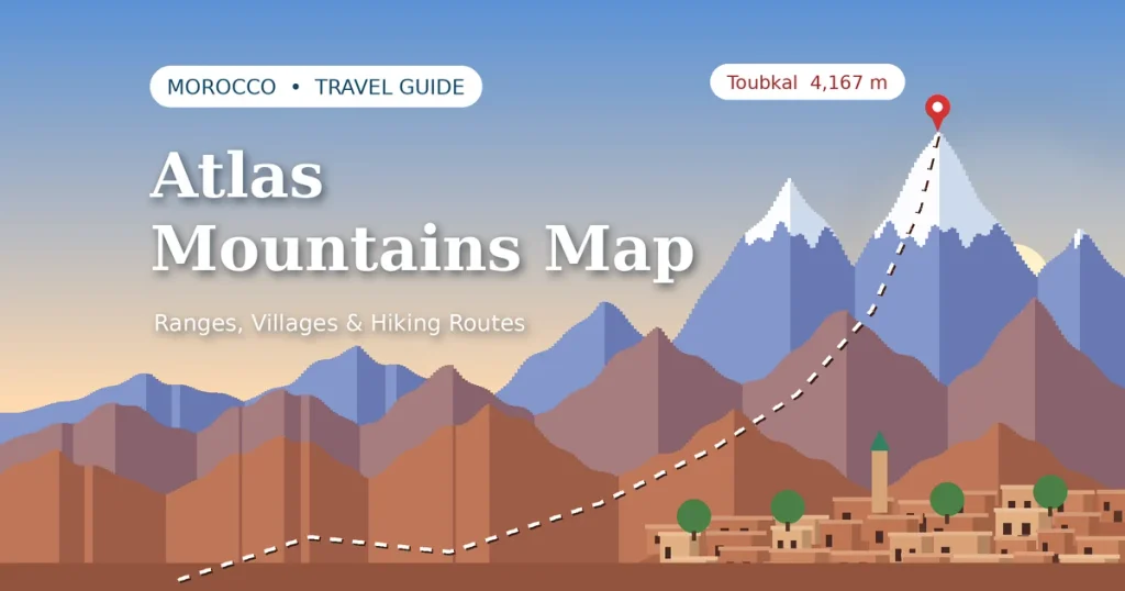
An Atlas Mountains map helps you discover one of Morocco’s most beautiful regions. It shows mountain ranges, traditional villages, hiking routes, valleys, and roads connecting major destinations. Use it to plan a short escape from Marrakech or a longer adventure across the country.
The Atlas Mountains offer much more than high peaks. You can explore Amazigh villages, walk through green valleys, visit waterfalls, and enjoy dramatic mountain scenery. With the right route, you can also combine your mountain trip with a visit to the Sahara Desert.
Where Are the Atlas Mountains in Morocco?
The Atlas Mountains stretch across northwestern Africa. In Morocco, they run through the country’s central and southern regions, separating parts of the Atlantic-facing interior from areas closer to the Sahara. The range includes high peaks, rocky plateaus, fertile valleys, and dry landscapes.
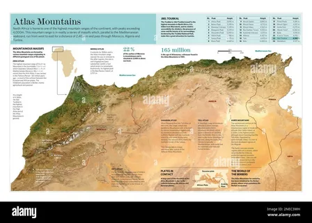
The mountains are also part of a wider North African system. The Atlas Mountains countries are Morocco, Algeria, and Tunisia. However, Morocco is especially popular with travellers because it offers accessible mountain towns.
What Part of Morocco Are the Atlas Mountains?
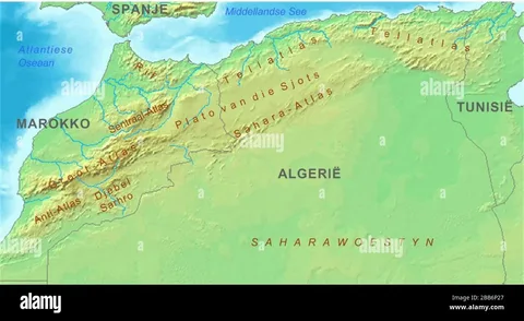
The mountains cross central and southern Morocco. The High Atlas lies south of Marrakech, while the Middle Atlas extends farther north. The Anti-Atlas occupies areas farther south, near the edge of the Sahara.
Important Destinations to Identify on Your Morocco Atlas Mountains Map Include:
- Marrakech: A major starting point for mountain day trips.
- Imlil: A village and popular base for High Atlas hikes.
- Mount Toubkal: Morocco’s highest mountain and a major trekking destination.
- Ourika Valley: Known for mountain scenery, villages, and rivers.
- Ouzoud Falls: A popular waterfall destination northeast of Marrakech.
- Ifrane: A town in the Middle Atlas known for its cooler climate and nearby forests.
- Tafraoute: A scenic town in the Anti-Atlas region.
- Ouarzazate: A useful stop when travelling between the mountains and desert.
Distances and travel times depend on your route. Mountain roads can be slow, so allow extra time for stops and changing conditions.
The Three Main Atlas Mountain Ranges in Morocco
Morocco’s Atlas system is commonly divided into three main ranges: the High Atlas, Middle Atlas, and Anti-Atlas. Each has its own scenery and travel opportunities. Morocco’s official tourism site describes the major ranges and their landscapes.
Choose your range based on your interests. The High Atlas suits high-altitude hiking, the Middle Atlas offers forests and cooler towns, and the southern range is ideal for exploring dry mountain scenery.
1. High Atlas Mountains
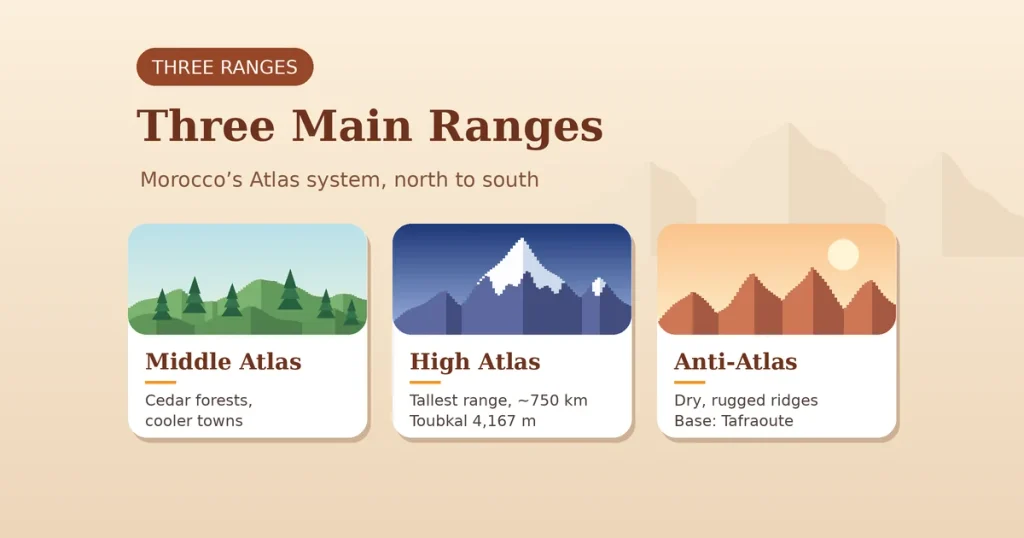
The High Atlas is the tallest and most dramatic section of the range. It stretches for roughly 750 kilometres and includes Mount Toubkal, the highest peak in North Africa. Snow may cover its highest areas in winter, while lower valleys can be green and mild during spring. Source: Moroccan National Tourist Office.
Imlil is a popular base for walking and trekking. From here, visitors can explore mountain paths, local villages, and routes toward Toubkal. You can also choose a shorter guided walk if you do not want to climb a high peak.
2. Middle Atlas Mountains
The Middle Atlas lies north of the High Atlas. Its landscape includes cedar forests, rolling hills, plateaus, and mountain towns. The area around Ifrane is known for cooler weather and green spaces.
This range is a good choice for travellers who prefer forest walks and scenic drives. You can explore local towns or plan nature stops along a longer Moroccan road trip. Conditions vary by season, especially at higher elevations.
3. Anti-Atlas Mountains
The Anti Atlas Mountains lie farther south, near the Sahara-facing part of Morocco. Their landscape is generally drier and more rugged than the greener areas of the Middle Atlas. You will find rocky ridges, traditional settlements, and wide open views.
Tafraoute is a useful base for exploring this region. The area is popular with visitors who want to see a quieter side of Morocco. Spring can bring pleasant temperatures and seasonal flowers, although local conditions vary.
Atlas Mountains Morocco Map: Main Areas to Know
When studying an Atlas Mountains map of Morocco, look for the main mountain ranges first. Then identify the cities, villages, valleys, and roads that connect them. This makes it easier to understand which destinations fit into one trip.
The High Atlas is the best-known mountain area for visitors travelling from Marrakech. The Middle Atlas is farther north, while the Anti-Atlas is farther south. Do not assume every destination is close to the others. Mountain routes can take longer than the distance on a map suggests.
Mount Toubkal on the Morocco Atlas Mountains Map
Mount Toubkal stands at 4,167 metres above sea level. It is the highest mountain in Morocco and the highest peak in North Africa. It sits in the High Atlas, within Toubkal National Park, south of Marrakech. Source: Visit Marrakech.
Climbers often travel through Imlil before starting the trek. A summit trip usually takes more planning than a simple day walk. Weather, fitness, altitude, and trail conditions all matter. Consider hiring a qualified local guide, especially if you have little mountain experience.
The phrase Atlas Mountains’ highest peak refers to Mount Toubkal. You can locate it on a map by searching for “Mount Toubkal” or “Toubkal National Park.”
Atlas Mountains Near Marrakech
Marrakech is one of the most convenient gateways to the High Atlas. The city sits near mountain landscapes that are visible from some viewpoints on clear days. You can arrange day trips to nearby valleys or stay overnight in a mountain village.
Popular options include Imlil and the Ourika Valley. Some trips focus on scenery and village visits, while others include hiking. Check the exact route before booking because different tours cover different areas. The official Marrakech tourism guide offers advice on planning mountain outings.
Atlas Mountains and Moroccan Culture
The Atlas Mountains are home to many Amazigh communities. Their languages, architecture, food, crafts, and farming traditions are an important part of Morocco’s cultural heritage. Visitors may see terraced fields, stone houses, and villages built along mountain slopes.
Travel respectfully when visiting these communities. Ask before photographing people or private homes. Choose local guides and businesses when possible. This can make your visit more informative while helping support the communities you meet.
Best Things to Do in the Atlas Mountains
The mountains offer activities for different fitness levels and travel styles. You can spend a few hours exploring a valley or plan a multi-day trek. Your choices will depend on the season, road access, and how much time you have.
Hiking and Trekking
Walking is one of the best ways to experience the Atlas Mountains. Routes range from gentle village paths to steep climbs at high altitude. Choose a route that matches your fitness and experience.
For longer hikes, check weather forecasts and trail conditions. Bring suitable footwear, water, sun protection, and warm layers. Mountain temperatures can change quickly, even when Marrakech feels hot.
Visit Amazigh Villages
Mountain villages offer a closer look at local life. You may see traditional homes, small markets, farms, and family-run guesthouses. Some guided visits also include a traditional meal or tea with local hosts.
Be considerate when entering villages. Follow your guide’s advice and ask permission before taking photographs. A respectful visit helps preserve the welcoming atmosphere of these communities.
Explore Mountain Valleys
Valleys such as Ourika and Imlil offer scenic walks and views of surrounding peaks. Depending on the season, you may see rivers, orchards, terraced fields, and snow in the distance.
A valley visit works well for travellers who do not want a demanding climb. You can enjoy a walk, stop for lunch, and return to Marrakech later in the day. Check road conditions before setting out.
Visit Waterfalls
Waterfalls are another popular reason to explore the region. Ouzoud Falls is a well-known excursion, while smaller cascades may be accessible in some valleys during suitable conditions.
Water flow changes with rainfall and season. Some paths can be steep or slippery, so wear shoes with good grip. Confirm access locally before making a long journey.
Combine the Mountains With the Sahara
A longer Moroccan itinerary can connect the Atlas Mountains with desert destinations. Travellers often combine mountain scenery with stops around Ouarzazate and the Draa Valley before continuing toward the Sahara.
Do not underestimate the distances. A trip that includes trekking and desert travel may need several days. Plan overnight stops rather than trying to cover every destination in one long drive.
Best Time to Visit the Atlas Mountains
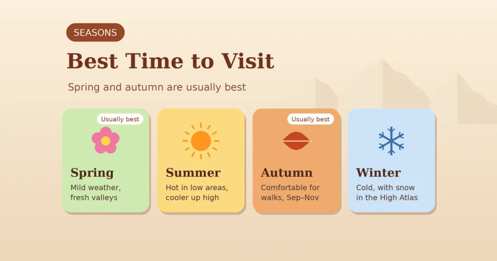
The best season depends on your route and planned activities. Spring and autumn usually offer comfortable conditions for hiking and sightseeing. Higher peaks can remain cold, and winter weather may affect access. Source: Moroccan National Tourist Office.
Spring
Spring generally brings mild weather and fresh scenery in many valleys. It is a good season for village walks, photography, and lower-altitude hikes. Snow may still affect high mountain routes.
Summer
Summer can be hot in lower areas, but higher elevations may offer cooler conditions. Start hikes early and carry enough water. Check the forecast before attempting demanding routes.
Autumn
Autumn is another good period for walking and road trips. Temperatures often become more comfortable after summer. September through November can work well, but conditions change with altitude.
Winter
Winter brings cold temperatures and possible snow to the High Atlas. Some routes become more challenging or require specialised equipment. If you plan a winter hike, check current conditions and seek local advice.
How to Read a Morocco Atlas Mountains Map
Start by identifying Marrakech, then locate the High Atlas to its south. Mark your intended destination, such as Imlil, Ourika Valley, or Mount Toubkal. Next, check the road route and estimated travel time.
For digital navigation, search Atlas Mountains Google Maps to view roads, towns, and landmarks. You can open Google Maps and search the Atlas Mountains. Save key locations before travelling, but do not rely on your phone alone in remote areas.
Atlas Mountains Map for Morocco Travel Planning
Use your map to build a realistic itinerary. It is usually easier to explore one mountain area properly than to rush between distant ranges. The following examples can help you choose a route.
Short Mountain Escape
Spend one day exploring a nearby valley from Marrakech. Visit a village, enjoy a short walk, and stop for lunch with mountain views. This option suits travellers with limited time.
High Atlas Adventure
Allow two or more days for the High Atlas if you want longer hikes. Use Imlil as a base for local walks or a guided trekking route. A Mount Toubkal climb needs extra preparation and may require an overnight stay.
Mountains + Desert
Travel through the High Atlas toward Ouarzazate, then continue toward a desert destination. Add overnight stops to make the journey more comfortable. This route works best when you have several days available.
Grand Morocco Journey
Combine Marrakech, the Atlas Mountains, historic towns, and the Sahara on a longer trip. Check the map carefully before setting your schedule. The best route depends on your arrival city, available days, and preferred activities.
Why Visit the Atlas Mountains?
The Atlas Mountains offer a different experience from Morocco’s busy cities. You can enjoy dramatic landscapes, quiet villages, outdoor activities, and a rich cultural heritage. The scenery also changes from one range to another.
A map helps you choose the right area and avoid unnecessary travel. Whether you want a short day trip or a multi-day trek, planning ahead makes the journey easier. Respect local communities and prepare for changing mountain conditions.
Plan Your Atlas Mountains Adventure
Before travelling, decide whether you want gentle walks, high-altitude trekking, cultural visits, or a road trip. Then mark your destinations and check the travel times between them. Book a local guide for challenging routes and confirm weather conditions before departure.
Keep essential supplies with you and save an offline map. Pack layers, water, and suitable footwear. With a practical route and realistic schedule, the Atlas Mountains can become one of the highlights of your Morocco trip.
Frequently Asked Questions
Where are the Atlas Mountains in Morocco?
They cross central and southern Morocco, with the High Atlas south of Marrakech and the Middle and Anti-Atlas ranges farther north and south.
What is the highest mountain in Morocco?
Mount Toubkal is the highest mountain in Morocco, reaching 4,167 metres.
Are the Atlas Mountains close to Marrakech?
Yes. Parts of the High Atlas are accessible on a day trip from Marrakech, while longer hikes may require an overnight stay.
What are the three Atlas mountain ranges in Morocco?
The three main ranges are the High Atlas, Middle Atlas, and Anti-Atlas.
Can I visit the Atlas Mountains and Sahara Desert on the same trip?
Yes. Many travellers combine the mountains with desert destinations, but you should allow several days for the journey.
Is Mount Toubkal part of the Atlas Mountains?
Yes. Mount Toubkal is in the High Atlas range and lies within Toubkal National Park.